As an incident commander, it gives me a visual I can't get any other way. What the drone sees is live streamed directly to our command post. There also is a link that can be shared and, with it, you can pull up what the drone sees on your computer or phone.


DFR for Academic Campuses
Campus safety demands complete coverage.
Skydio Drone as First Responder (DFR) is the force multiplier that expands situational awareness and strengthens safety across events, incidents, and daily campus operations.
Academic campuses operate like small cities—major events, constant movement, and incidents that unfold quickly. Skydio DFR gives campus safety teams immediate situational awareness with autonomous drones that launch in seconds, showing responders what’s happening so they can act faster and stay safer with the resources they have.
Demand on campus safety teams keeps rising while resources stay the same.

Calls come from everywhere at once.
Quads, residence halls, garages, labs, and stadiums all generate activity at the same time. One response can leave other areas uncovered when calls stack up.
Large events require hours of attention.
Football games, concerts, graduations, and other large scale events require long periods of overwatch and coordination, pulling officers from other parts of campus when demand is already high.
Incidents unfold without clear information.
Medical calls, suspicious activity, and missing-student reports often arrive with limited detail, adding pressure to teams already managing heavy activity across campus.
See more and respond faster, even as demand grows.
Skydio DFR adds an automated aerial unit to your team—launching in seconds to deliver live intelligence, broader coverage, and clearer decision-making during everyday calls and critical incidents.


From alert to action: The DFR workflow.
Once an alert is triggered, the nearest drone is already en route. Within moments, dispatchers and responders gain the context they need to act decisively.


THIS PRODUCT OR SERVICE HAS NOT BEEN APPROVED OR ENDORSED BY ANY ACADEMIC INSTITUTION, AND THIS OFFER IS NOT BEING MADE BY AN AGENCY OF THE ACADEMIC INSTITUTION.
Real-world impact
Over a 30 day period, 61 agencies shared their results from using Skydio DFR.
69 %
of incidents had a drone first on scene
23 %
of calls were cleared without any patrol response
92 %
of deployments involved drones providing critical situational awareness
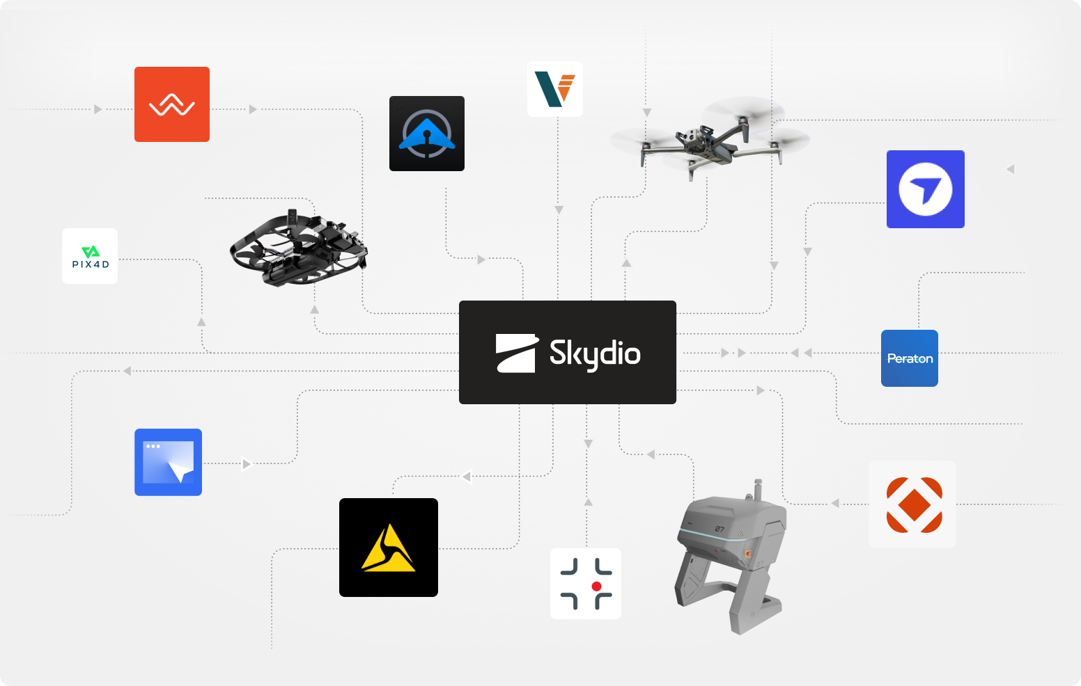
A family of flying robots built for the demands of campus public safety.
Working together on one common platform for consistent performance across complex campuses.
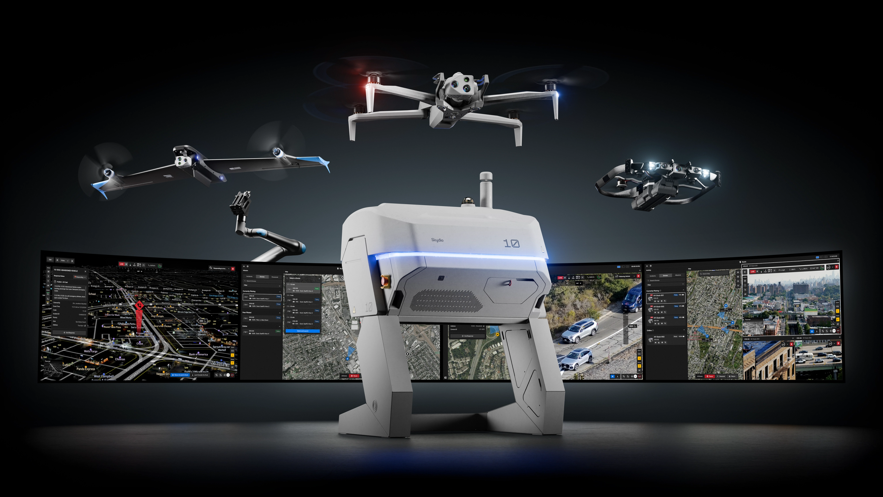
Skydio X10
X10 puts eyes over the scene outdoors. Launched in seconds from patrol vehicles or Dock hives, it streams live video through DFR Command—tracking subjects, following vehicles, and providing real-time overwatch day or night.

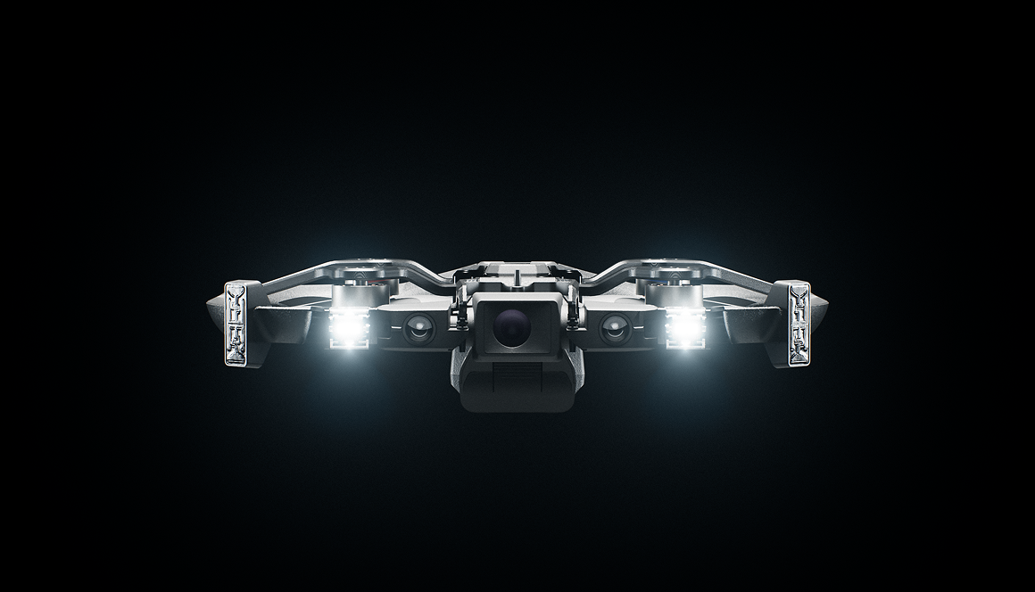
Skydio R10
R10 puts eyes indoors before officers enter. Compact and rugged, it’s launched by patrol officers and flown manually or handed off to a remote pilot through DFR Command. It streams live video, lights dark spaces, and puts two-way communication in the room.
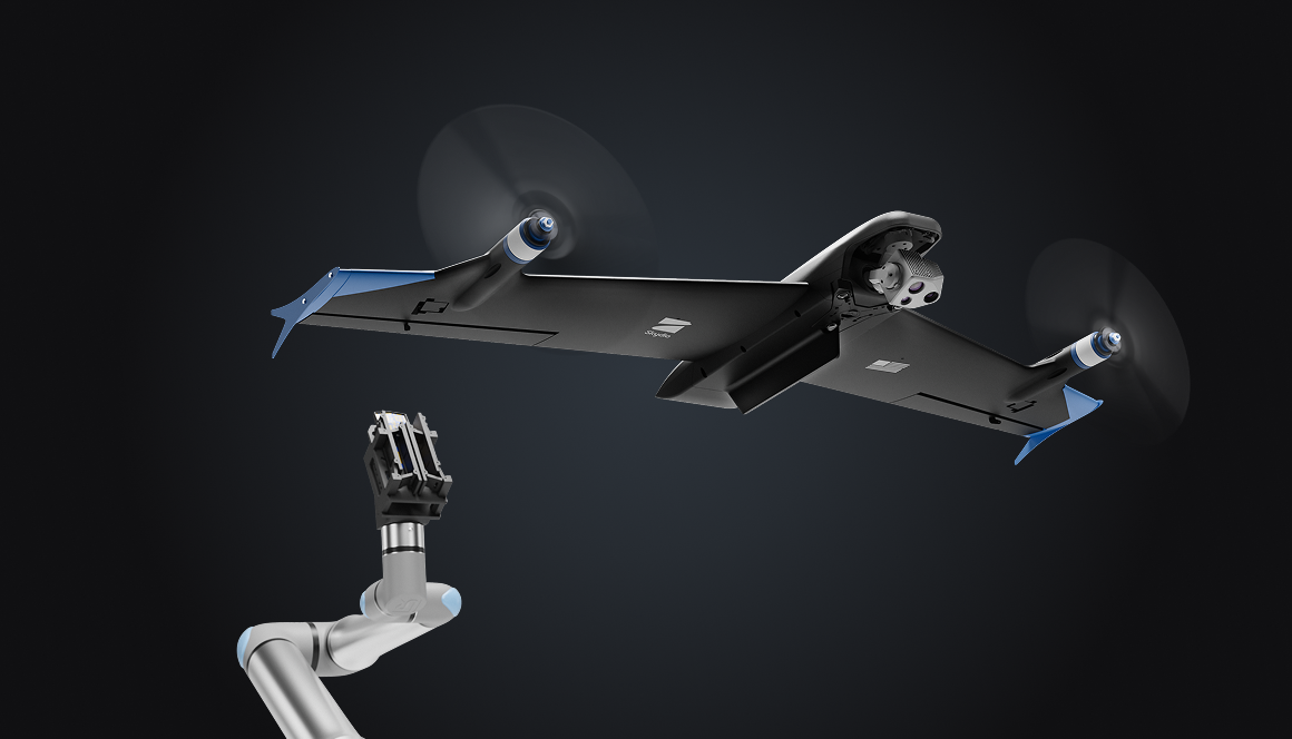
Skydio F10
Coming soon: F10 extends the radius of DFR coverage to dozens of miles, responding to long-distance calls, sustaining coverage for extended incidents, and keeping pace when speed is critical.
Instant launch and handoff
Dock makes operations persistent. Strategically placed Dock hives keep X10s ready in the right locations. Connected to CAD and NG911 through DFR Command, operators launch the nearest drone instantly for faster response, broader coverage, and 24/7 operations.
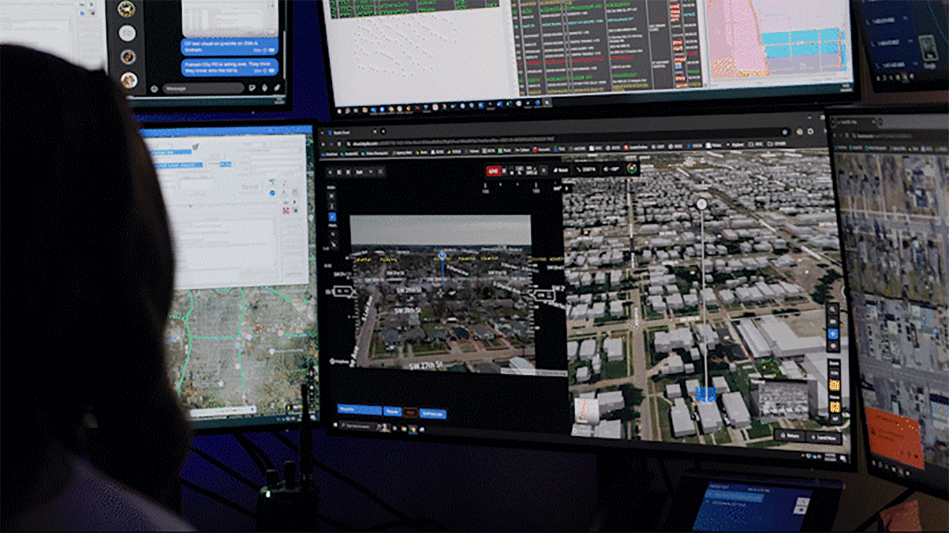
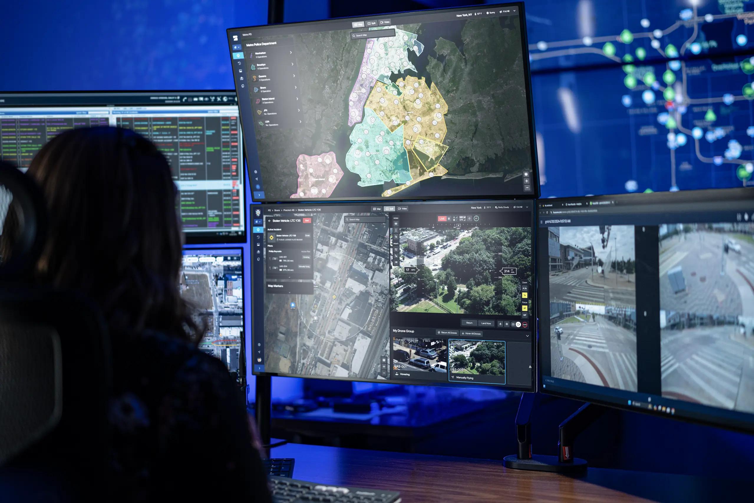
Unified command view
Skydio Remote Operations is the operation system for campus security. From a single view, remote operators launch and manage Skydio drones, respond to multiple calls, and stream live video to patrol and command through ReadyLink. Integrated with CAD. Manage all your drones in a single interface for simplified fleet management.
Natively integrated
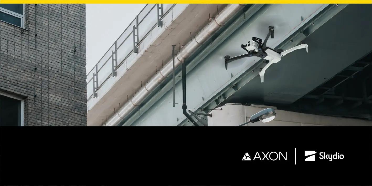
DFR Command integrates natively with the systems campus facilities already use. From RapidSOS and CAD at dispatch, to live operations through Axon Fusus with body-worn and fleet cameras, to automatic evidence upload into Axon Evidence, every step of the workflow is integrated.
Autonomy that thinks ahead.
Avoid obstacles, fly pre-approved routes, and navigate tree-lined quads without GPS.
Designed for privacy and transparency.
DFR operations follow clear flight policies, geofenced routes, and access controls to ensure every flight serves a defined purpose. All footage is encrypted and stored within agency-approved systems.

Fly where others can’t.
Only Skydio combines trusted autonomy, resilient connectivity, and advanced navigation to operate in places and conditions where other systems fail.
Connect Fusion
Seamlessly switch between point-to-point and 5G links for the most reliable connectivity across expansive or complex sites.

NightSense
Autonomously avoid obstacles in darkness or low-light environments. Fly 24/7 operations with confidence.

Pathfinder
Automatically fly the safest and most efficient route, avoiding terrain, buildings, and geofences to get on scene fast.

Dedicated support team & expert guidance
Security veterans
Our teams have years of experience from law enforcement, military, and homeland security — they know what it takes to stand up reliable, secure operations. We guide every step, from planning and site setup to integration and data delivery.

Regulatory services
We have experts dedicated to helping you navigate FAA requirements to fly fully autonomously, beyond visual line of sight (BVLOS), with no visual observer.

Training
We get your team up to speed fast with training and certification to manage scheduled and unplanned flights from any browser, anywhere in the world.

Success services
More than support—partnership. Our team guides every phase of your program, ensuring you get operational fast and stay successful as you scale.

DFR supports more than just emergency response.
The same DFR platform also supports the day-to-day operations that keep a campus running.
Facilities management.
Inspect roofs, stadium structures, and utilities quickly after storms or as part of preventative maintenance, reducing costs and avoiding shutdowns.

Transit and parking safety.
Oversee shuttles, parking lots, and garages where thefts and incidents are common. Respond faster and more effectively without adding more patrol officers.

Environmental hazards.
Support emergency response for chemical spills in labs, flooding from storms, or smoke from nearby wildfires. Assess risk zones safely and direct evacuations if needed.

Autonomous campus mapping.
Document your campus with autonomous capture using 3D Scan. Use 2D mapping for pre-event planning and 3D modeling to preserve historic architecture and support long-term facilities planning and restorations.

Let us help you build a successful DFR program.
Join a live online demo.
See Skydio DFR in action, as we fly real-time missions in a quick 30-minute small group session.
Fly in Skydio Paraverse.
Get hands on. Fly Dock-based DFR in your own city in our virtual environment, navigating from your browser using DFR Command.
Start building a plan.
Let us help you turn your vision into a plan that provides immediate results and a path to grow.
Resources
Learn more about building a DFR program with Skydio.

Smarter Response, Safer Cities: Real Results from DFR Programs Vol 1.2

Highway DFR: Accelerating safer, smarter road response

DFR Operational Readiness Guide

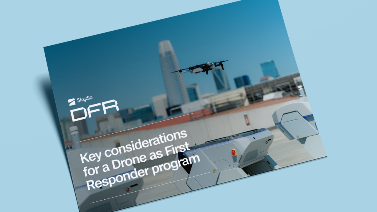
Drone as First Responder in action: Real results
Skydio DFR Command Makes Drone as First Responder Programs a Reality for Public Safety Agencies of All Sizes.
Elevating First Response: Skydio and Axon’s Integrated Approach to Drone as First Responder Programs.